Canyonlands National Park: One Park, Four Unique Districts
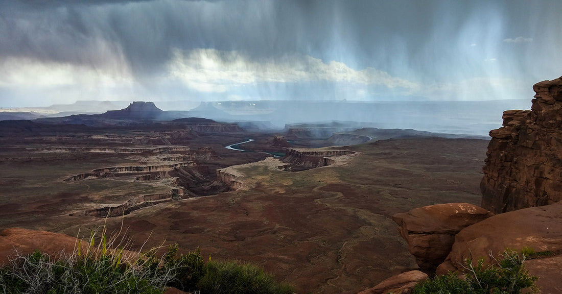
Robert DeckerCanyonlands preserves the natural beauty and human history throughout its four districts, which are divided by the Green and Colorado rivers. Here you'll see colorful canyons, mesas, buttes, fins, arches, and spires in the heart of southeast Utah's high desert. Water and gravity have been the prime architects of this land, sculpting layers of rock into the rugged landscape you see today. While the districts share a primitive desert atmosphere, each retains its own character and offers different opportunities for exploration and adventure. Author Edward Abbey, a frequent visitor, described the Canyonlands as "the most weird, wonderful, magical place on earth—there is nothing else like it anywhere."
At Canyonlands National Park you can explore a wilderness of countless canyons and fantastically formed buttes carved by the Colorado River and its tributaries. Rivers divide the park into four districts: Island in the Sky, The Needles, The Maze, and the rivers themselves. These areas share a primitive desert atmosphere, but each offers different opportunities for sightseeing and adventure.
Islands in the Sky

The Island in the Sky mesa rests on sheer sandstone cliffs over 1,000 feet above the surrounding terrain. Every overlook offers a different perspective on Canyonlands' spectacular landscape. Island in the Sky is the easiest area of Canyonlands to visit in a short period of time, offering many pullouts with spectacular views along the paved scenic drive. Hiking trails or four-wheel-drive roads can take you into the backcountry for a few hours or many days.
The Needles

The Needles forms the southeast corner of Canyonlands and was named for the colorful spires of Cedar Mesa Sandstone that dominate the area. Hiking trails offer many opportunities for long day hikes and overnight trips. Foot trails and four-wheel-drive roads lead to such features as Tower Ruin, Confluence Overlook, Elephant Hill, the Joint Trail, and Chesler Park.
The Maze
The Maze is the least accessible district of Canyonlands. Due to the district's remoteness and the difficulty of roads and trails, travel to the Maze requires more time. Visitors must be prepared for self-sufficiency and the proper equipment or gear for self-rescue. Rarely do visitors spend less than three days in the Maze, and the area can easily absorb a week-long trip.
Horseshoe Canyon

Horseshoe Canyon contains some of the most significant rock art in North America. The Great Gallery, the best known panel in Horseshoe Canyon, includes well-preserved, life-sized figures with intricate designs. Other impressive sights include spring wildflowers, sheer sandstone walls and mature cottonwood groves along the intermittent stream in the canyon bottom. Horseshoe Canyon was added to Canyonlands in 1971.
The Rivers
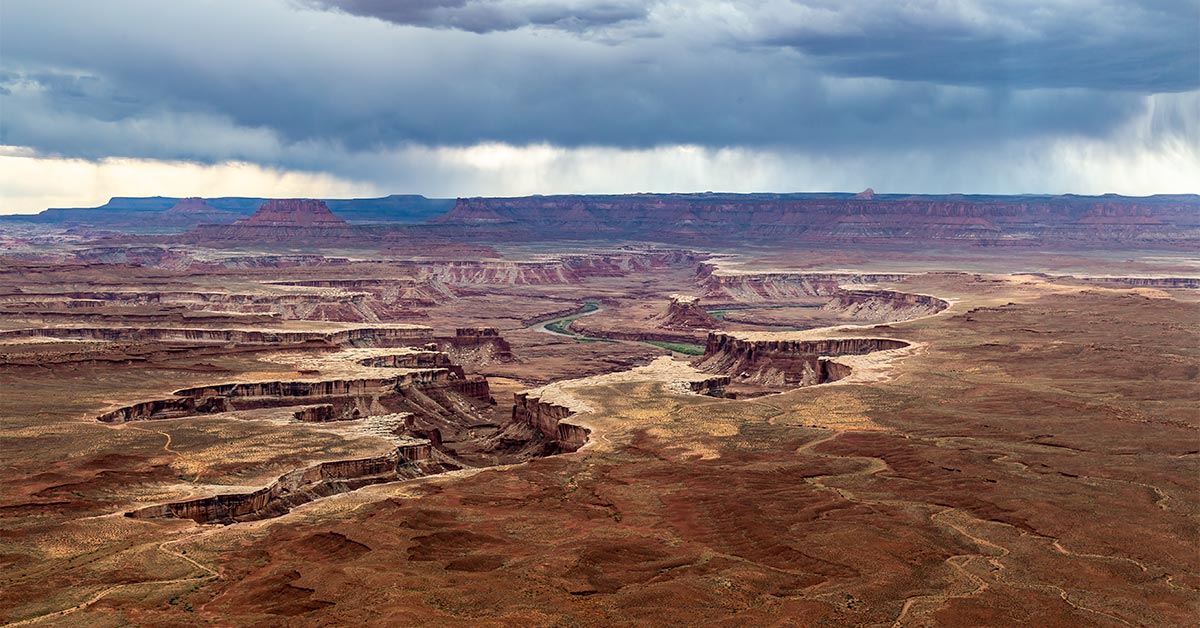
The Colorado and Green rivers wind through the heart of Canyonlands, cutting through layered sandstone to form two deep canyons. In stark contrast to the hot, sunny desert above, the river corridors are remarkably green, shady, and full of life. Both rivers are calm upstream of The Confluence, ideal for canoes, kayaks and other shallow water craft. Below The Confluence, the combined flow of both rivers spills down Cataract Canyon with remarkable speed and power, creating a world-class stretch of whitewater.
Though they appear close on a map, there are no roads that directly link the districts. Traveling between them requires two to six hours by car as there are few places to cross the rivers. Get directions. Most people find it impractical to visit more than one area in a single trip.
A Little History...
In the early 1950s, Bates Wilson, then superintendent of Arches National Monument, began exploring the area to the south and west of Moab, Utah. After seeing what is now known as the Needles District of Canyonlands National Park, Wilson began advocating for the establishment of a new national park that would include the Needles. Additional explorations by Wilson and others expanded the areas proposed for inclusion into the new national park to include the confluence of Green and Colorado rivers, the Maze District, and Horseshoe Canyon.
In 1961, Secretary of the Interior Stewart Udall was scheduled to address a conference at Grand Canyon National Park. On his flight to the conference, he flew over the Confluence (where the Colorado and Green rivers meet). The view apparently sparked Udall's interest in Wilson's proposal for a new national park in that area and Udall began promoting the establishment of Canyonlands National Park.
In September 1964, after several years of debate, President Lyndon B. Johnson established Canyonlands as a new national park. Bates Wilson became the first superintendent of the new park. He is often referred to as the "Father of Canyonlands."

Click Here to See the Canyonlands National Park Poster!
Rob Decker is a photographer and graphic artist who studied under Ansel Adams in Yosemite National Park when he was just 19 years old. Now, he's creating iconic WPA-style posters for each of our National Parks. Click Here to learn more about his story and The National Park Poster Project.