

Best Things to do at Black Canyon of the Gunnison National Park
Robert Decker8 Best Things to Do at Black Canyon of the Gunnison National Park
Deep. Steep. Narrow. Few places in the National Park System feel quite as dramatic as Black Canyon of the Gunnison National Park.
Here in western Colorado, the Gunnison River has cut a dark, spectacular gorge through nearly two-billion-year-old Precambrian rock, exposing sheer walls, knife-edged spires, and some of the steepest canyon scenery in North America.
The canyon reaches a maximum depth of 2,722 feet, narrows to just 40 feet at the river, and extends for 48 miles overall—14 of them within the national park boundary. :chatgpt-content-reference{index="0"}
My name is Rob Decker, and I’m a photographer and graphic artist who has spent more than 50 years exploring and photographing America’s National Parks and public lands. Black Canyon is one of those places that instantly reminds you how powerful geology can be.

Black Canyon was first protected as a national monument in 1933 and was redesignated as a national park on October 21, 1999. The park is divided into a South Rim and North Rim, with no bridge or road connecting them inside the park. Driving from one rim to the other can take more than two hours. :chatgpt-content-reference{index="1"}
Black Canyon at a Glance
- Established: National Monument in 1933; National Park in 1999
- Greatest depth: 2,722 feet
- Narrowest point: 40 feet at the river
- Canyon length: 48 miles total; 14 miles within the national park
- Best for: Scenic drives, viewpoints, hiking, climbing, fishing, wilderness adventures, and stargazing
- International Dark Sky Park: Designated in 2015
The canyon walls are so steep and close together that some sections receive very little direct sunlight. The resulting shadows can make the cliffs appear almost black.
1. Drive the South Rim Road
For most first-time visitors, the South Rim is the best introduction to Black Canyon.
The paved South Rim Drive follows the canyon edge for about 7 miles from Tomichi Point to High Point and provides access to 12 overlooks. Most overlooks require a short walk from the road. :chatgpt-content-reference{index="2"}
If you only have a few hours, this is where I’d spend them.
Don't Miss These South Rim Stops
- Gunnison Point: Near the South Rim Visitor Center
- Pulpit Rock: A broad view into the canyon
- Chasm View: One of the most dramatic perspectives into the gorge
- Painted Wall: A classic view of the canyon's striped rock face
- Sunset View: A fitting place to end the day
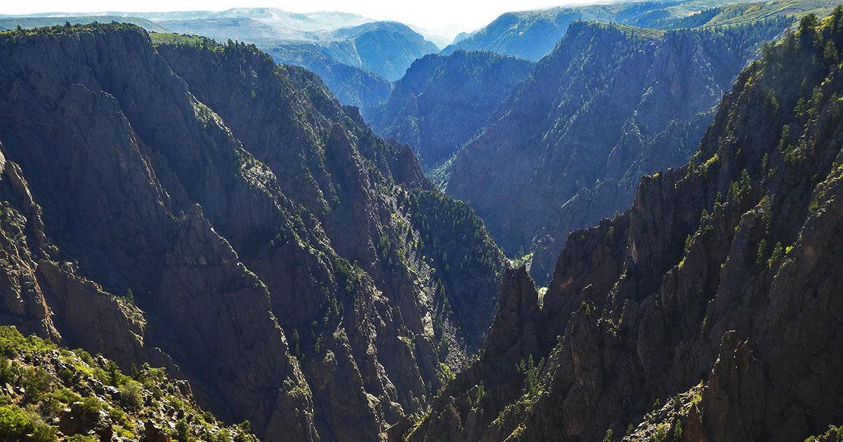
NPS recommends roughly two to three hours to stop at several overlooks. The road is short, but the views are not.
2. Hike the Rim Trails
You don't need to descend into the canyon to experience it on foot.
Both rims offer established hiking trails ranging from easy walks to more challenging routes, with dramatic viewpoints along the way. :chatgpt-content-reference{index="3"}
South Rim Trails
Popular choices include the Rim Rock Nature Trail, Oak Flat Loop, Cedar Point Nature Trail, and Warner Point Nature Trail.
North Rim Trails
The quieter North Rim includes the North Vista Trail and Deadhorse Trail, both of which offer a more primitive experience.
Even short rim trails can provide completely different perspectives from the roadside overlooks. If you have time, get out of the car and walk.
3. Explore the North Rim
The North Rim feels wilder and less developed than the South Rim.
A gravel access road leads to the rim, where the North Rim Road serves six overlooks. The walls here are nearly vertical in places, and services are limited. :chatgpt-content-reference{index="4"}
The reward is solitude.
If you prefer fewer people, quieter viewpoints, and a more rugged atmosphere, the North Rim is well worth the extra effort.
The North Rim is seasonal and more primitive than the South Rim. Check road and campground conditions before making the drive.
4. Descend Into the Inner Canyon
This is where Black Canyon turns from sightseeing into serious wilderness travel.
Inner-canyon routes are not maintained hiking trails. They are steep, unmarked wilderness routes with loose rock, route-finding challenges, poison ivy, and substantial elevation change. :chatgpt-content-reference{index="5"}
For experienced hikers, the descent to the Gunnison River can be an unforgettable adventure.
For everyone else, the rim offers plenty.
All inner-canyon wilderness use requires a permit. For 2026, South Rim routes during the May 1–October 31 peak season require advance reservations through Recreation.gov, while North Rim permits remain limited and generally first-come, first-served. Permit procedures can change, so always check current NPS information before your trip. :chatgpt-content-reference{index="6"}
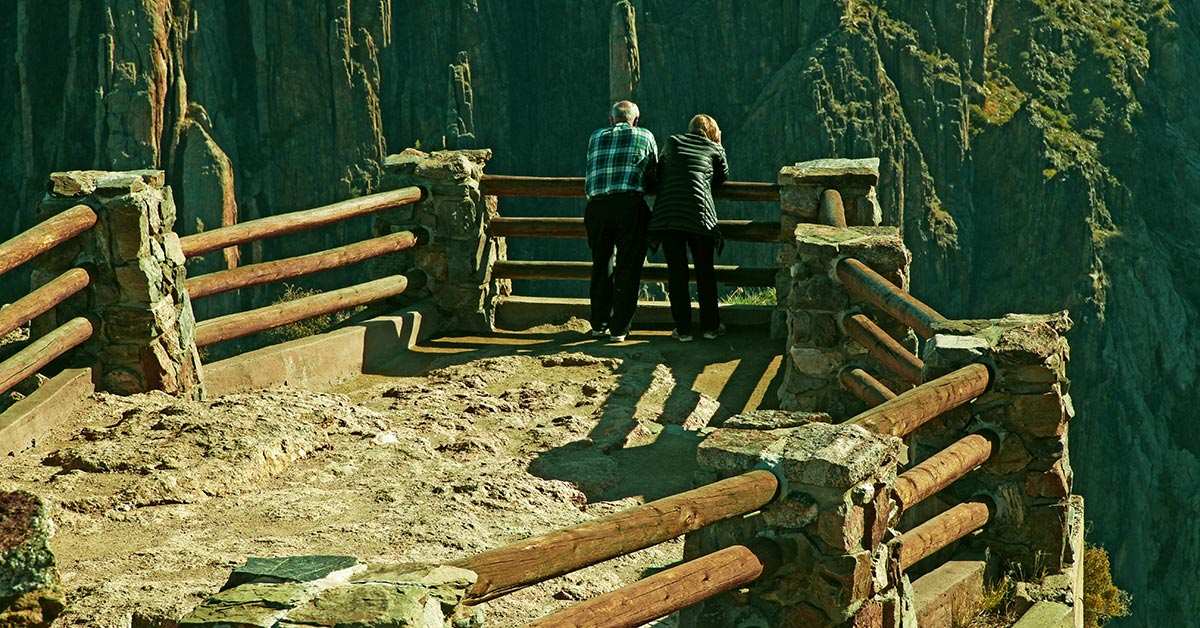
5. Drive Down to East Portal
The East Portal Road offers something completely different: a drive from the rim down to the Gunnison River.
The road is paved but extremely steep, with grades reaching 16% and tight hairpin curves. Vehicles longer than 22 feet, including trailers, are prohibited. :chatgpt-content-reference{index="7"}
East Portal itself lies within Curecanti National Recreation Area, not Black Canyon National Park, but the road is accessible only from inside the South Rim of Black Canyon.
If you're driving an RV, towing a trailer, or uncomfortable with steep mountain roads, enjoy the canyon from the rim instead.
6. Fish the Gunnison River
The Gunnison River through Black Canyon is designated Gold Medal Water and Wild Trout Water, making it one of Colorado's premier trout-fishing destinations. :chatgpt-content-reference{index="8"}
Rainbow and brown trout are common, and special regulations apply to protect the fishery.
A valid Colorado fishing license is required.
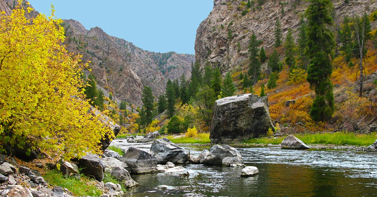
The easiest river access is generally via East Portal Road. Anglers who reach the river by inner-canyon routes should be prepared for serious wilderness travel.
Only a small fraction of Colorado's trout streams receive this designation, which recognizes waters capable of supporting outstanding trout fishing.
7. Rock Climb—or Leave the River to the Experts
Black Canyon is legendary among experienced climbers.
Its walls feature long, committing, traditional multi-pitch routes in a remote environment. This is not beginner climbing terrain. :chatgpt-content-reference{index="9"}
The Gunnison River is equally serious.
NPS describes the river through the park as suitable only for expert whitewater kayakers. Rapids include Class V water, some sections are unrunnable, and difficult portages are common. Rafting through the national park is not considered feasible. :chatgpt-content-reference{index="10"}
Black Canyon climbing and kayaking require advanced skills, specialized equipment, careful planning, and wilderness permits.
8. Stay for the Stars
When the sun disappears, Black Canyon offers an entirely different spectacle.
The park was designated an International Dark Sky Park in 2015 and remains one of Colorado's outstanding places for viewing the Milky Way and night sky. :chatgpt-content-reference{index="11"}
Summer programs may include constellation tours, telescope viewing, and astronomy programs led by rangers, volunteers, and local astronomers.
Scout your foreground before dark. Canyon edges, steep terrain, and limited lighting make this a place where preparation matters.
Wildlife Watching
Black Canyon's combination of rim, cliff, canyon, river, sagebrush, and woodland habitats supports an impressive range of wildlife.
Depending on where you explore, you may encounter:
- Bighorn sheep
- Black bears
- Mountain lions
- Bobcats
- River otters
- Beavers
- American dippers
- Gunnison sage-grouse
The park's extreme vertical landscape creates habitat from the sagebrush-covered rims all the way down to the Gunnison River. :chatgpt-content-reference{index="12"}
What About Horseback Riding?
Horseback riding is extremely limited inside Black Canyon.
The Deadhorse Trail on the North Rim is currently the only trail open to horses or pack animals for recreational day use. No horseback riding is permitted on the South Rim. :chatgpt-content-reference{index="13"}
How Much Time Do You Need?
If You Have...
- 2–3 hours: South Rim Drive and several major overlooks
- Half a day: Add a short rim hike and the visitor center
- One day: Explore the South Rim thoroughly and consider East Portal Road
- Two days: Add the North Rim or longer hikes
- More time: Plan fishing, climbing, wilderness routes, or night-sky photography
When Is the Best Time to Visit?
Season by Season
- Spring: Cooler weather, lighter crowds, and gradually improving road access
- Summer: Fullest access to both rims, scenic roads, campgrounds, and ranger programs
- Fall: Crisp temperatures, changing vegetation, and excellent hiking conditions
- Winter: Limited vehicle access, but opportunities for cross-country skiing and snowshoeing
The park itself is open year-round, but snow closes or limits several roads during winter. :chatgpt-content-reference{index="14"}
Black Canyon roads, trails, campgrounds, and climbing areas can be affected by snow, storms, fire impacts, and seasonal closures. Check the park's current conditions before heading out. :chatgpt-content-reference{index="15"}
Frequently Asked Questions About Black Canyon of the Gunnison
How deep is Black Canyon of the Gunnison?
The canyon reaches a maximum depth of 2,722 feet just north of Warner Point. :chatgpt-content-reference{index="16"}
How narrow is the Black Canyon?
At its narrowest point, the canyon is only about 40 feet wide at the Gunnison River. :chatgpt-content-reference{index="17"}
Why is Black Canyon called “black”?
The steep, narrow walls limit direct sunlight in portions of the canyon, leaving much of the rock in deep shadow.
Which rim should I visit?
The South Rim has more services, paved roads, the visitor center, and more overlooks. The North Rim is quieter, more primitive, and reached by gravel road.
Can you drive to the bottom of Black Canyon?
You can drive East Portal Road down toward the Gunnison River, but East Portal itself is within Curecanti National Recreation Area rather than the national park. The road is extremely steep and closed to vehicles longer than 22 feet. :chatgpt-content-reference{index="18"}
Do you need a permit to hike into the inner canyon?
Yes. Wilderness-use permits are required for all inner-canyon routes. Permit procedures vary by rim and season. :chatgpt-content-reference{index="19"}
Can you kayak the Gunnison River through Black Canyon?
Only expert whitewater kayakers should attempt it. The route includes Class V rapids, unrunnable sections, and difficult portages. :chatgpt-content-reference{index="20"}
Is Black Canyon good for stargazing?
Yes. The park has been an International Dark Sky Park since 2015 and offers excellent night-sky viewing. :chatgpt-content-reference{index="21"}
Bring Black Canyon Home
Black Canyon is an extraordinary subject for poster design.
The near-vertical walls, deep shadows, Gunnison River, and dramatic bands of ancient rock create a landscape that feels almost graphic already.
That combination inspired my Black Canyon of the Gunnison National Park Poster.

The design is an original work inspired by the visual language of classic WPA-era park artwork and celebrates one of Colorado's most dramatic landscapes.
Best Things to Do at Rocky Mountain National Park →
Learn About Great Sand Dunes National Park →
Best Things to Do at Mesa Verde National Park →
Explore the National Parks of the Grand Circle →
Love America's National Parks?
Join 125K+ fellow National Park enthusiasts for park stories, travel inspiration, new artwork, special offers, and more.